


Dewitt Voting District, Carroll County, Missouri
About
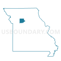
Outline

Summary
| Unique Area Identifier | 607388 |
| Name | Dewitt Voting District |
| County | Carroll County |
| State | Missouri |
| Area (square miles) | 46.12 |
| Land Area (square miles) | 44.60 |
| Water Area (square miles) | 1.52 |
| % of Land Area | 96.71 |
| % of Water Area | 3.29 |
| Latitude of the Internal Point | 39.40151460 |
| Longtitude of the Internal Point | -93.22790610 |
Maps


Graphs
Select a template below for downloading or customizing gragh for Dewitt Voting District, Carroll County, Missouri


Neighbors
Neighoring Voting District (by Name) Neighboring Voting District on the Map
- Brunswick Voting District, Chariton County, MO
- Cambridge Voting District, Saline County, MO
- Combs/Eugene Voting District, Carroll County, MO
- Miami Voting District, Saline County, MO
- Ridge/Rockford Voting District, Carroll County, MO
Top 10 Neighboring County Subdivision (by Population) Neighboring County Subdivision on the Map
- Cambridge township, Saline County, MO (2,431)
- Brunswick township, Chariton County, MO (1,383)
- Miami township, Saline County, MO (582)
- Ridge township, Carroll County, MO (441)
- De Witt township, Carroll County, MO (270)
- Combs township, Carroll County, MO (234)
- Eugene township, Carroll County, MO (163)
- Triplett township, Chariton County, MO (163)
- Rockford township, Carroll County, MO (98)
Top 10 Neighboring Place (by Population) Neighboring Place on the Map
Top 10 Neighboring Elementary School District (by Population) Neighboring Elementary School District on the Map
Top 10 Neighboring Unified School District (by Population) Neighboring Unified School District on the Map
- Carrollton R-VII School District, MO (5,621)
- Brunswick R-II School District, MO (1,603)
- Northwestern R-I School District, MO (1,032)
- Bosworth R-V School District, MO (692)
Top 10 Neighboring State Legislative District Lower Chamber (by Population) Neighboring State Legislative District Lower Chamber on the Map
- State House District 7, MO (34,548)
- State House District 22, MO (34,437)
- State House District 26, MO (33,935)
Top 10 Neighboring State Legislative District Upper Chamber (by Population) Neighboring State Legislative District Upper Chamber on the Map
Top 10 Neighboring 111th Congressional District (by Population) Neighboring 111th Congressional District on the Map
Top 10 Neighboring Census Tract (by Population) Neighboring Census Tract on the Map
- Census Tract 4702, Chariton County, MO (2,534)
- Census Tract 9601, Carroll County, MO (2,530)
- Census Tract 902, Saline County, MO (2,525)